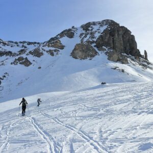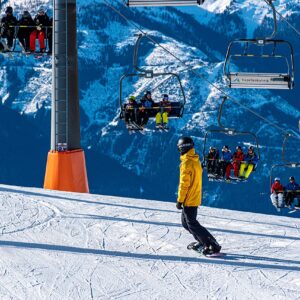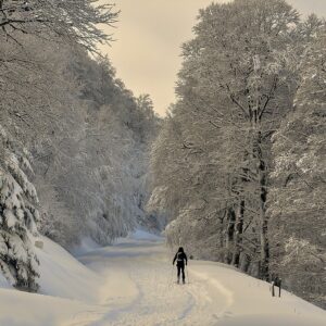
SKIING IN THE SNOW
Tags: outdoor, ski, snow, winter, wintersport
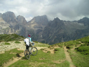
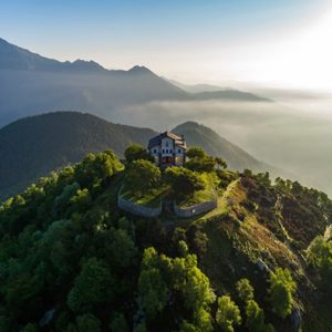
THE PANORAMICA ZEGNA
The Panoramica Zegna is a scenic road in the Province of Biella, and is highly popular among cyclists. The route was designed in the 1930s by the entrepreneur Ermenegildo Zegna as his spiritual will: in his enlightened vision it was to be a connecting link between the Alpine world and that of his woollen mill.
Cut at an altitude of 1,000 to 1,500 metres through birches, conifers and beech woods, mountain pastures and shepherds’ huts and at the height of the passes between Monte Rubello, Cima della Ragna, Monte Moncerchio and Monticchio, the Panoramica was constructed to unite the sacred and the profane. From the mountains of Trivero to the east it headed west towards the historical, geographical and spiritual heart of the area: the Sanctuary of Oropa which has, together with the Sacri Monti of Piedmont and Lombardy, been declared a UNESCO World Heritage Site. This is the same sanctuary chosen as the finish line for the 14th stage of the Giro d’Italia on 20th May 2017 and, in the 1999 Giro, the setting of a legendary climb by the great champion Marco Pantani.
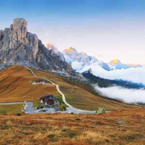
THE PASSO GIAU
The Passo Giau is a mountain pass in the Dolomites located at 2236 m. in the province of Belluno, linking the municipalities of Colle Santa Lucia and Selva di Cadore to Cortina d’Ampezzo. The Passo Giau is one of the legendary passes crossed by the Giro d’Italia – celebrated above all for the section on the slopes of Colle Santa Lucia and Selva di Cadore – due to its toughness (lasting 10.1 km with an average gradient of 9.1%) and constancy; the Cortina d’Ampezzo side is shorter (8.6 km) and slightly easier (average gradient 8.3%) but still very demanding, since the average gradient is disguised by some easy initial sections followed by a very tough and constant middle and final part. It makes for a spectacular and panoramic ascent, with views of numerous mountain peaks (Marmolada, Tofane, Cristallo, Sorapiss, Croda da Lago, Lastoni di Formin, and Cadini di Misurina).
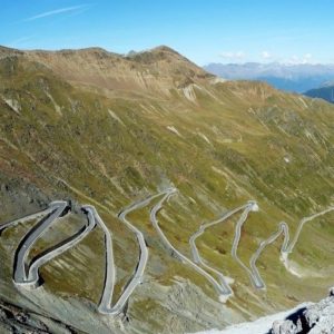
THE PASSO DELLO STELVIO
The Passo dello Stelvio is a pass at an altitude of 2,758 m a.s.l. that – only during the summer – connects Lombardy, Switzerland and South Tyrol via the highest road accessible to vehicles in Europe. The Passo dello Stelvio generally opens in the second half of May, being closed from the first few days of November.
The road to the pass is immersed in a natural park through an area steeped in history. This particularly relates to the First World War, with trenches and numerous military remains bearing witness to a sad and gruelling period of history and – secondly – the world of cycling and some legendary exploits along the stages of the Giro d’Italia.
The climb up the Passo dello Stelvio, classified as a long alpine ascent with a large elevation gain, a high final altitude and gradients of average difficulty, is an alluring and demanding climb from all three sides (Italian and Swiss). The most difficult part, however, is the Italian-South Tyrolean section which, starting from Prato allo Stelvio (915 m a.s.l.), climbs for nearly 26 km at steadily increasing gradients (about 11% in the last kilometre).
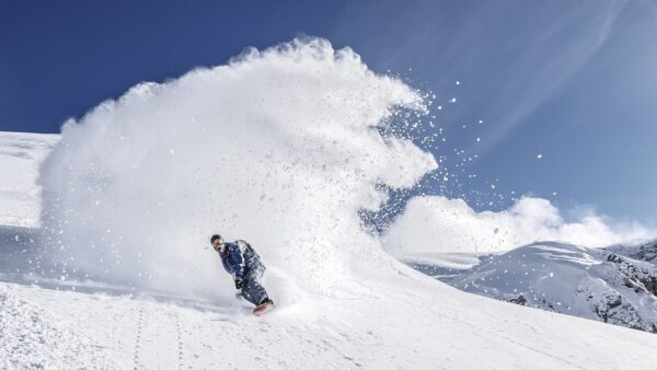
For more and more people, winter is synonymous with mountain sports. Skiing, snowboarding, ski mountaineering and cross-country skiing are just some of the most popular disciplines. As in all sports, […]